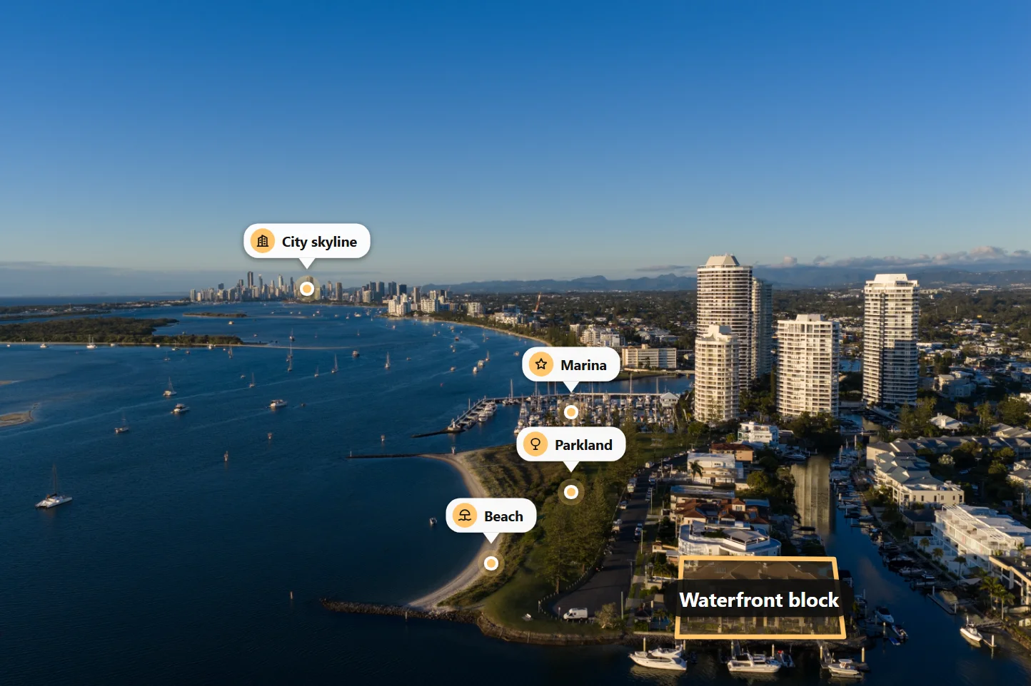
A drone photo shows a beautiful home. A drone photo with the land marked shows buyers what they are actually buying. Where does the block end? How big is it? How far is the beach, the school, the station? The land boundary tool in Studio AI answers all of that on one image, in a few minutes, in your browser.
Why boundary photos sell
- Buyers understand the land at a glance. A fence line hidden by trees, a long back garden or a corner block is hard to see in a normal photo. An outline makes it obvious.
- Location becomes visible. Pins for the beach, schools, shops and transport show the lifestyle, not just the house.
- Land listings finally look good. An empty block is a hard photo to sell. A clear outline with the area and nearby places turns it into a strong lead image.
- It stops the scroll. A clean, marked aerial looks professional and stands out among plain listing photos.
How it works
- Open a drone photo. Use a photo from your order, or upload one straight inside the tool.
- Click the corners of the block. The outline follows your clicks, and you can drag any corner to adjust it.
- Add the land area. Type it in, or enter the real length of one side and let the tool work out the area for you, free.
- Pin nearby places. Add the name and distance, such as "Beach 400 m" or "Train station 5 min".
- Choose a style and save. Preview everything for free, and save the finished photo when you are happy.
Make it match your brand
Every listing is different, so the tool gives you real choice without making it complicated:
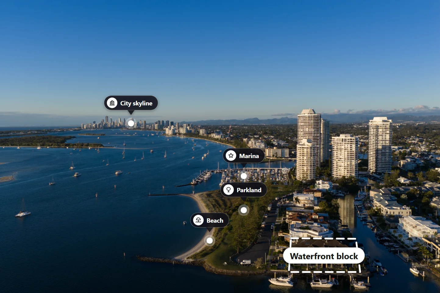
- Outline styles: clean, soft glow, dashed, neon, double line or corner dots, in nine colours or any colour you pick;
- Fill: leave the block clear, or add a light or medium tint;
- Make the block stand out: darken, blur or turn the surroundings black and white, so the eye goes straight to the land;
- Pins: floating cards, glass pills, map pins, numbered badges or radar pulses, with simple line icons for schools, beaches, stations, shops, hospitals, parks, cafés and more;
- Text: choose the label style, the font and the size, from small to extra large;
- Compass: a compass rose, an arrow or a simple marker, turned to the photo's real north;
- Side lengths: show the length of each side on the photo if you want;
- Your logo on the finished image.
Tips for the best result
- Shoot straight down when you can. A top-down drone shot shows the true shape of the block and gives an exact area. An angled shot looks more dramatic but the area is an estimate.
- Use the official plan. Draw the outline from the title or survey plan, not from memory or the fence line.
- Keep it simple. Three or four pins are easier to read than ten. Pick the places buyers care about most.
- Use one style per listing. Keep the same colour and pin style across all the boundary photos of one property.
- Label it as indicative. Add a short note such as "Boundary indicative only" in the listing. The outline is a marketing guide, not a survey.
Part of the Listing Bundle
Three boundary photos are included in the Studio AI Listing Bundle, together with a property website, brochure, social clip and slideshow, paid once per property. Read more in one bundle to market a home for sale, or see every product in our Studio AI overview.
Try it on your next listing
Studio AI is launching soon, and new accounts get free credits to try it. Take a drone photo from your next listing, mark the block and the places nearby, and see how much clearer the listing becomes.